Edited by: Vanessa Linares, M.A. Student at the Department of Archaeology and Ancient Near Eastern Cultures, Tel Aviv University who volunteered at the 2013 & 2014 CTV Excavation Season. The video presents work at the "Slaves' Hill" (Site 34), the Merkavot Site (the mines), camp life and excursions to sites in the Timna Valley and adjacent areas - following the history of copper production technologies as reflected in the athis short video presents some highlights of the 2013 (February) Excavation Season of the CTV Project.
Main Features of the 2013 Field Season
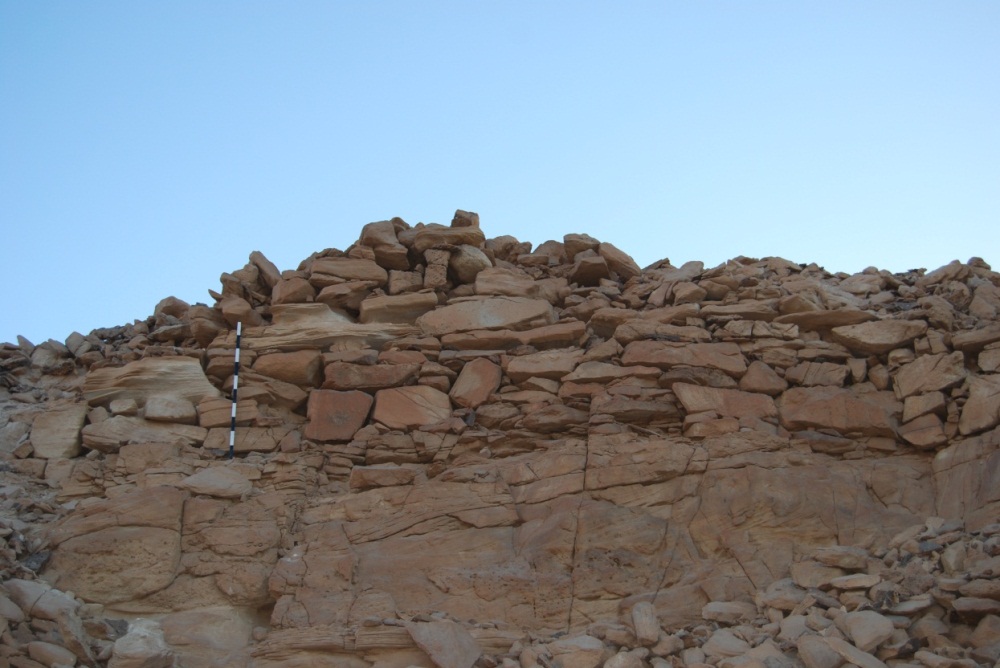
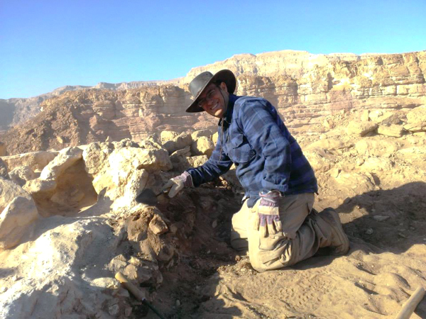
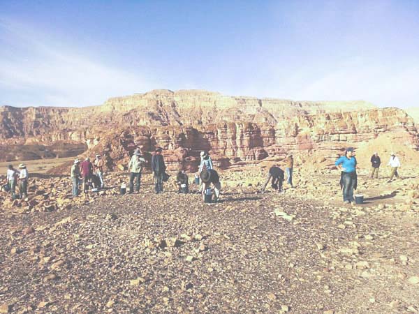
Slaves' Hill: A Probe into Slag Mound 19
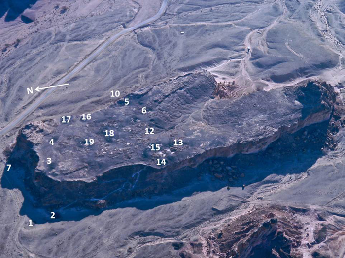
The Slaves' Hill from the air and its slag mounds (coutesy of A. Avner)
Probe into Slag Mound 19 - ca. 150 years of copper smelting at the site
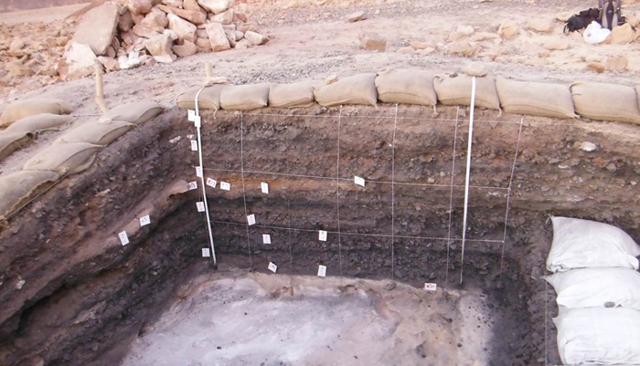
Slag Mound 19 (above) is made up of remains from an ancient industrial copper smelting operation where copper is separated from the ore that it is imbedded in by intensely heating it in a furnace to the point that the copper melts out. It is composed of multiple layers of industrial waste byproducts consisting of varying combinations of charcoal, ash, slag, tuyeres, and organic material that have been deposited one on top of the other over a period of time (see the section).
Why was Square 19A chosen?
The position of Square 19A was chosen on the thicker and higher southeastern side of the mound in order to try and capture the longest possible usage sequence in the stratigraphic section. In addition it was chosen in such a way that it could later be extended directly to the south in order to explore the relationship between it and one of the obvious semi-circular features located in Square 19B (See also Figure for Square 19B [below]).
Square 19A
Square 19A was excavated from the irregular upper surface located on the top of the mound down to the top of uneven bedrock at the bottom. The maximum deposition thickness was slightly over one meter. A total of 32 individual horizons (layers) were identified in the southwestern wall section that cumulatively represent approximately 150 years of operation . In contrast to Square 19B there were no obvious man-made architectural features found in Square 19A.
Date of Site 34
The amount and quality of indicative ceramic finds was poor. However, Slag Mound 19 yielded a multitude of high quality short lived seeds found in well controlled contexts for dating purposes and this allowed a precise absolute chronology for this site to be established based upon a bank of eleven AMS 14C results that are dated to the 10th century BCE. The overall production technology as seen in the slag and the tuyeres represented at this site corroborate the 14C dating. The high amounts of copper in the slag and the two-pieced tuyere found in the charcoal pocket in Square B are consistent with smelting technology in the Late Bronze Age and early Iron Age. The lack of large Type A slag, with its distinct appearance as solid slabs with a glassy viscous nature and low residual copper content indicate the site’s production ended sometime before the technological improvement in copper-smelting which occurred later during the Iron Age II.
Use of Site 34
Even though people were working and eating at this site, there are no finds that suggest workers were sleeping directly around Slag Mound 19. Domestic facilities were somewhere else. Despite the fact that a rich accumulation of copper production debris has been deliberately dumped in this location, no in situ furnace installations were found. There are numerous fragments of tuyeres, charcoal, and slag; however, there was very little ore collected and no clearly identifiable fragments of furnace wall clay were found. A few dimpled hammerstones and large flat stones crushing bases were found in the loess filled center of Slag Mound 19 and were also observable at other locations in the nearby vicinity. These factors together suggest that the area around Slag Mound 19 mainly functioned as a slag crushing facility, the main purpose of which was to remove copper prills from post-smelted material that was relatively high in copper content.
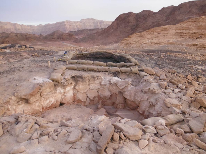
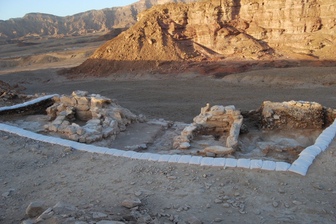
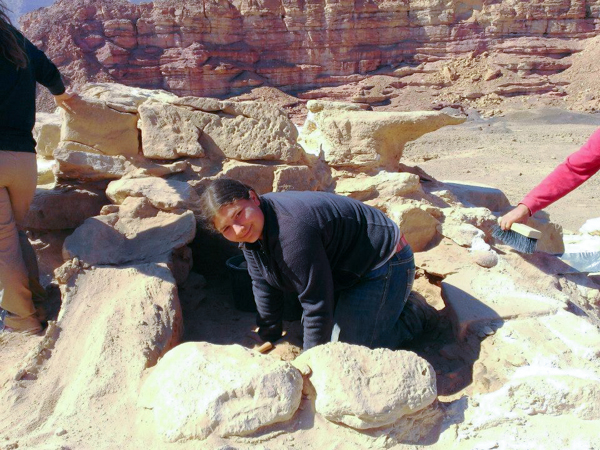
Slaves' Hill: Installation 19B
Slaves' Hill: Installation 19B at the end of 2013 Season
The installation in Square B (Installation 19B) is one of numerous circular (or eliptical) features seen on the surface of the Slaves' Hill. It was constructed of sandstone blocks, many of which look as if they have been intentionally placed with a flat surface on at least one side. The wall of this structure was built directly on the bedrock and is preserved to a height of four stone courses. Part of the collapse material found in the middle indicates that the structure probably was originally higher. In addition, there were large flat stones brought in to make a floor. A red colored mortar was used under the floor pavement and in between many of the wall stones. The structure in Square B can tentatively be identified as a storage area and perhaps a cooking facility for the workers at the site. The size of the room is relatively small and round, and the floor is irregular, suggesting that it was not intended for workers to sleep in. There was an intentional floor made of large flat stones; this floor, as well as the stones in the walls were sealed with a red mortar. There is one crushing basin that may have been used for cooking purposes, since if the facility was used strictly for crushing slag we would expect to find more indication of crushing inside this room.
Area Supervisors: Willie Ondricek and Ilana Peters
Main Features of the 2014 Field Season
The goals of the 2014 season were to help clarify the copper smelting technology employed, further our knowledge of the people smelting copper at Site 34, and to continue to clarify the chronology of occupation for the entire historical sequence of usage present at the Slave's Hill (Site 34). In addition to continued excavations at Slag Mound 19, the expedition opened a new area to expose the gate house at the crest of the hill as well as undertaking an extensive mapping and walking survey of the hill top.
Stop motion video, 2014 exacavations of the gate house structure
By the volunteers from the Eilat Field School
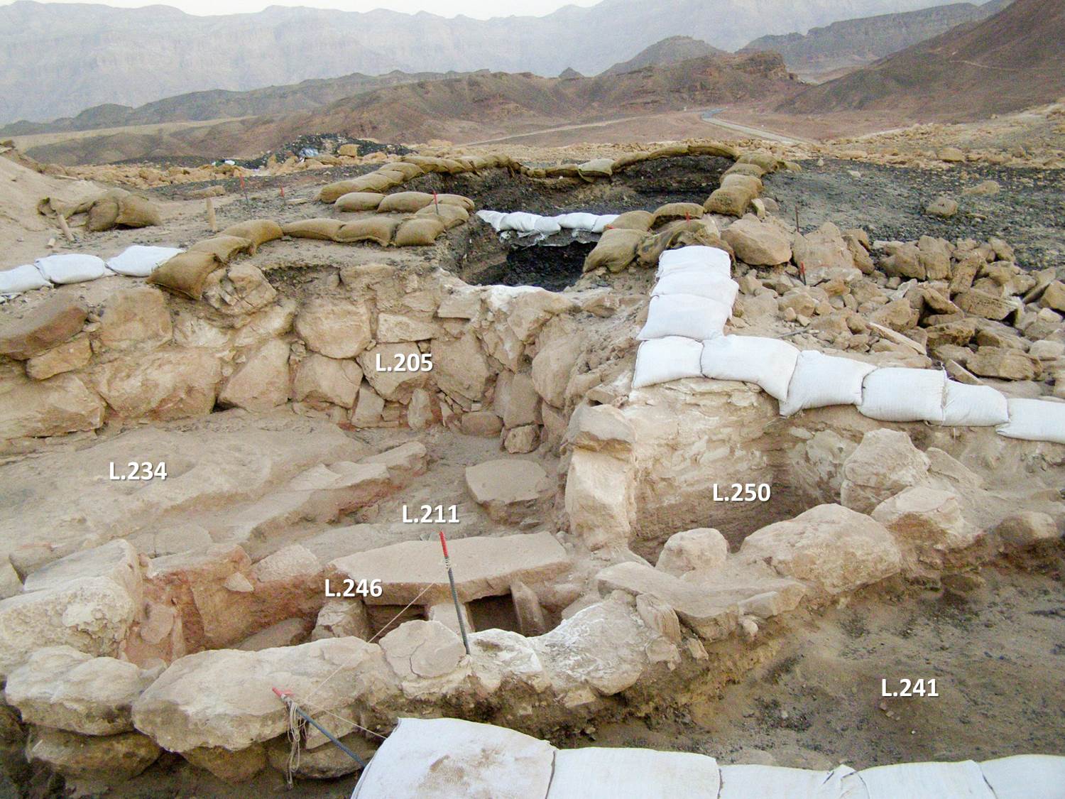
Slave's Hill: Expansion of Installation B
One of the major goals of the 2014 field season was to continue our inventigation of Installation 19B, the semicircular structure south of Slag Mound 19. The excavation area was expanded to the south, and to the east and west (Square C to the south, Squares D and E to the east of C, and Squares F and G to the west of C) in order to uncover the remaining portions of the installation's structure. Excavation in each of these squares was completed to bedrock. A second east-west wall was uncovered to the south of the 2013 wall, as well as two small circular installations in the northeast portion of the structure (seen below in L.246 and L.250). Walls were preserved up to three courses and constructed from irregular sandstone fieldstones. The bedrock floor of the installation was altered possibly to accomidate for the smelting activity happening within the structure, leading excavators to the conclusion that the installation served as a metallurgical workshop. This was furthered by the remains of partially smelted ore and slag fused to areas of the bedrock floor.
Installation B looking northwest
Finds from within the structure included grinding and hammer stones, animal bones, various shells, seeds and cereal grains, charcoal, slag, beads, textile and cordage, tuyere and other technological ceramic fragments and copper ore.
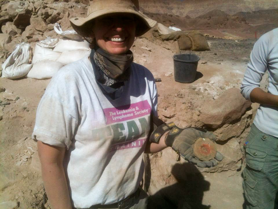
Laura holds an intact tuyere
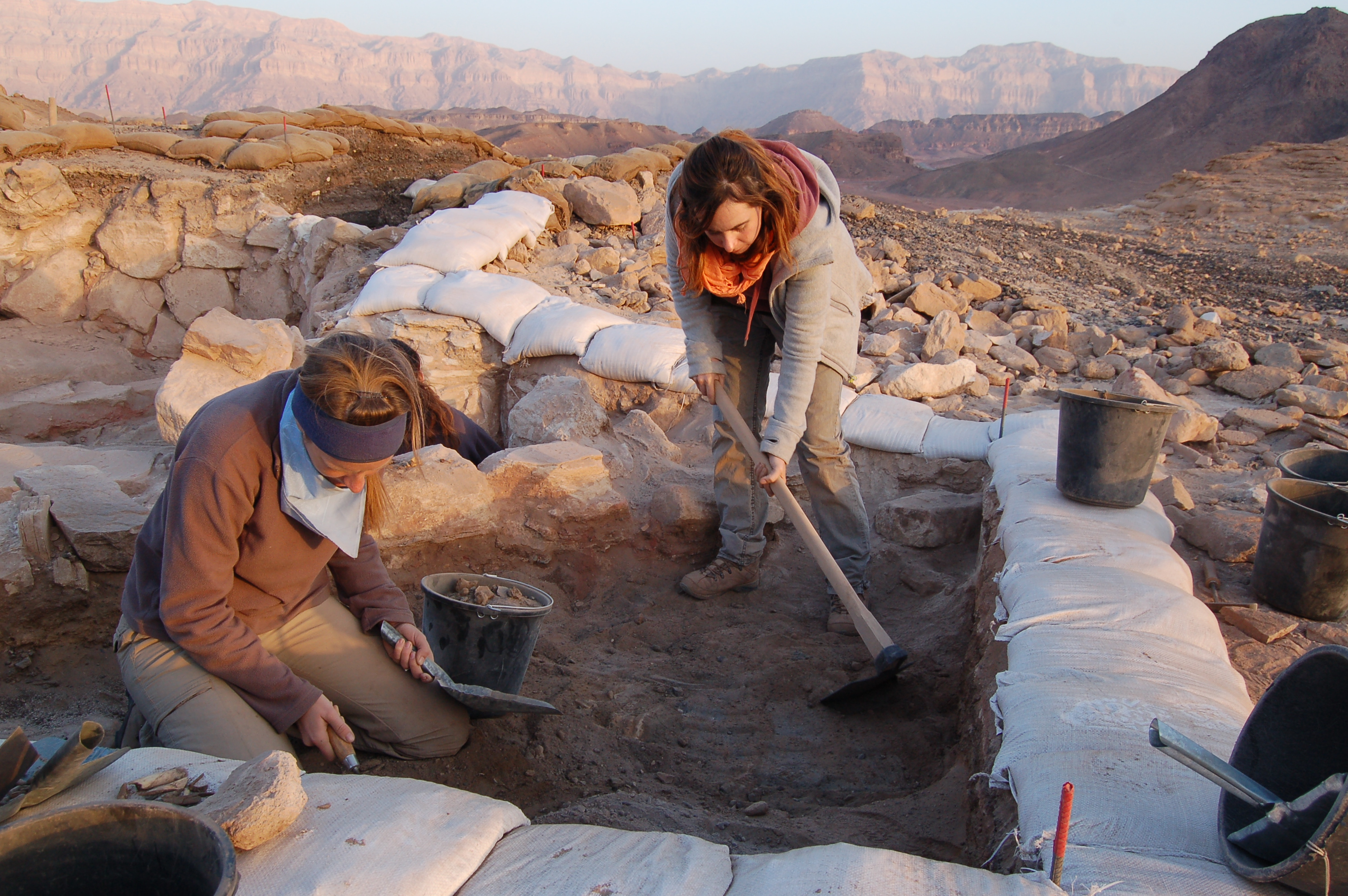
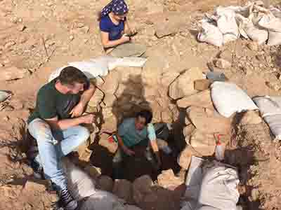
Volunteers Lyndell and Lisa(left) and Vanessa L.(right) work to expose Installation B
Created by: Vanessa Workman, M.A. Student at the Department of Archaeology and Ancient Near Eastern Cultures, Tel Aviv University.
Model created using Agisoft's PhotoScan Professional
"Slave's Hill": Gate House
A new excavation area was opened on the northwest corner of Site 34. The area was identified by B. Rothenberg in the 1960's as the gate and main access point onto the "Slave's Hill", however it was not excavated until CTV 2014. Prior to excavation the gate was marked by two large piles of field stones, making it clear that the remains of a structure stood beneath.
Path leading up to gate house at Site 34
While excavating it became apparent that two phases of construction are present. The initial building phase consisted of the tall outer wall (pictured below), which today is preserved to at least 8 courses in some areas while having completely collapsed over the hill's precipitous edge in others. Later, two small, rectangular rooms were installed flanking the main entrance point to the site. These room may have served as sentry point for guards or small storage rooms for smelting/living resources.
Below the paving stones of the gate house, a layer of finely ground slag and sandstone was uncovered. The layer presumably represents a pre-gate occupation that engaged in the smelting of copper ores. The secondarily built defense system may suggest a change in the political climate in the area and a need to protect the valuable smelting operation.
Well-preserved portion of the outer wall
All varieties of workers would enter through this point. Based on the copious amount of animal hair found within the excavated area, pack animals were among those entering Site 34 and were stabled just inside the area's walls. They most likely carried wares and resources to the metal workers.
Southward view of the gate area.
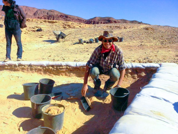
Dry seiving on site
The faces of the gate house excavation
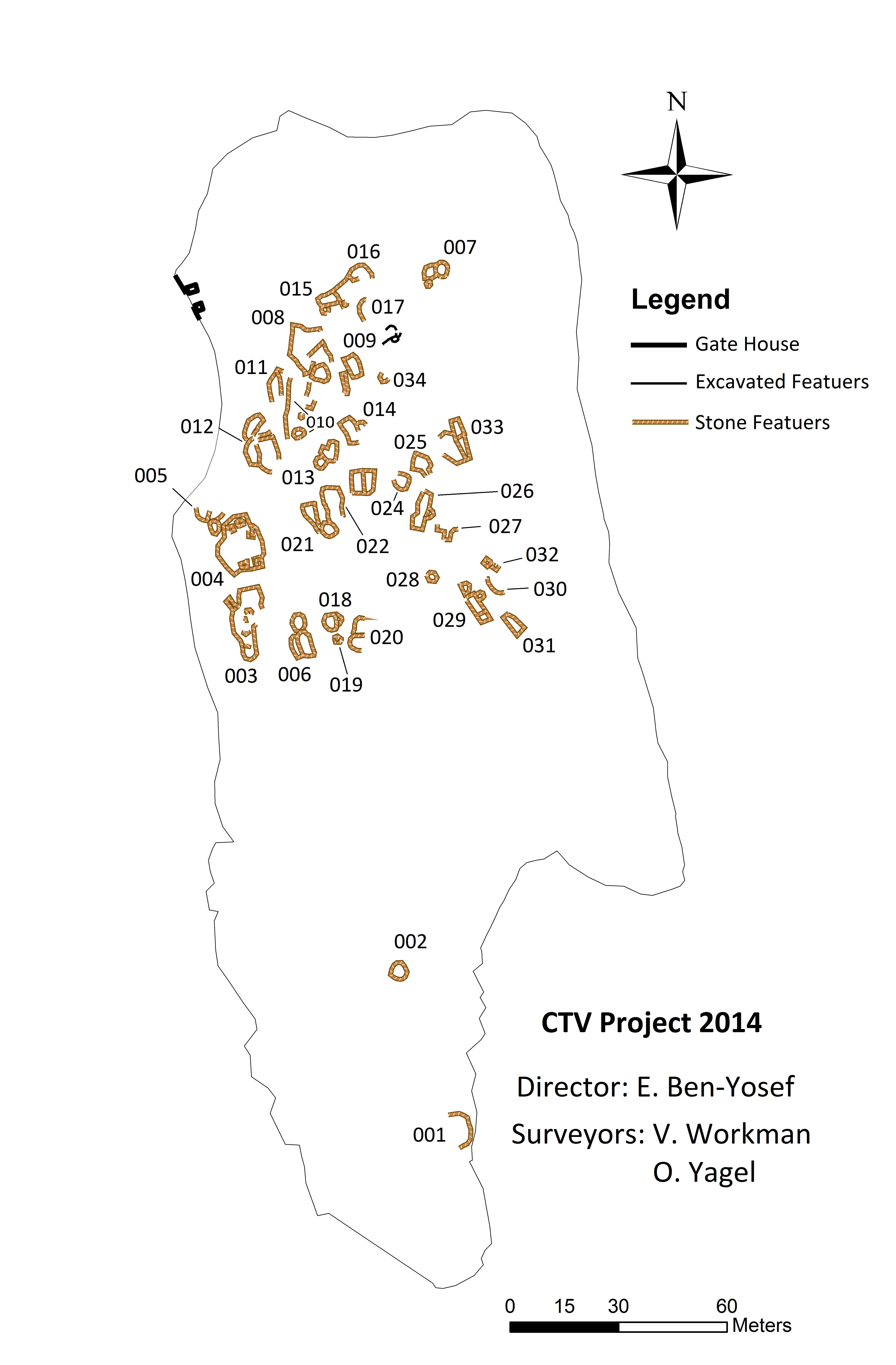
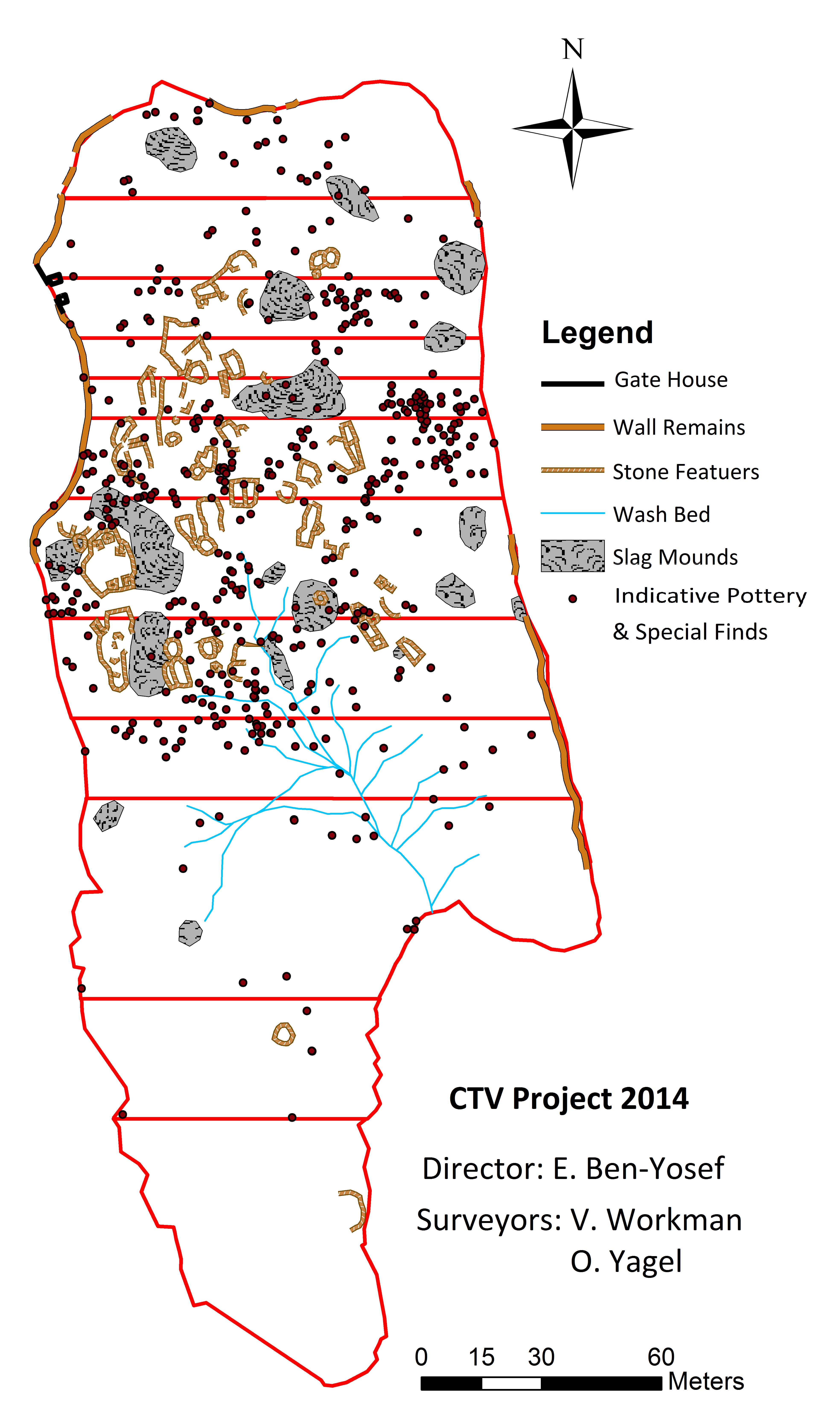
High Resolution Survey of Site 34
Methodology: In order to better understand the spatial relations of ST34 (''The Slave's Hill''), a major mapping project was conducted during the 2014 field season. The main objective was to produce a high-resolution map representing all the visible archaeological remains at site 34.
The produced map is an 'easy to manage' geographical visual aid, allowing viewers to better understand the relationship between the archaeological remains, but also enabling far better understanding of the interrelations between the archaeological remains and the topographical features (ex. washed pottery and natural water flow).
Beyond enabling spatial understanding of Site 34, another objective was to create a tool for managing the archaeological work at the site. Thus, a local grid was created in order to help maintain excavated areas within geographical constraints.
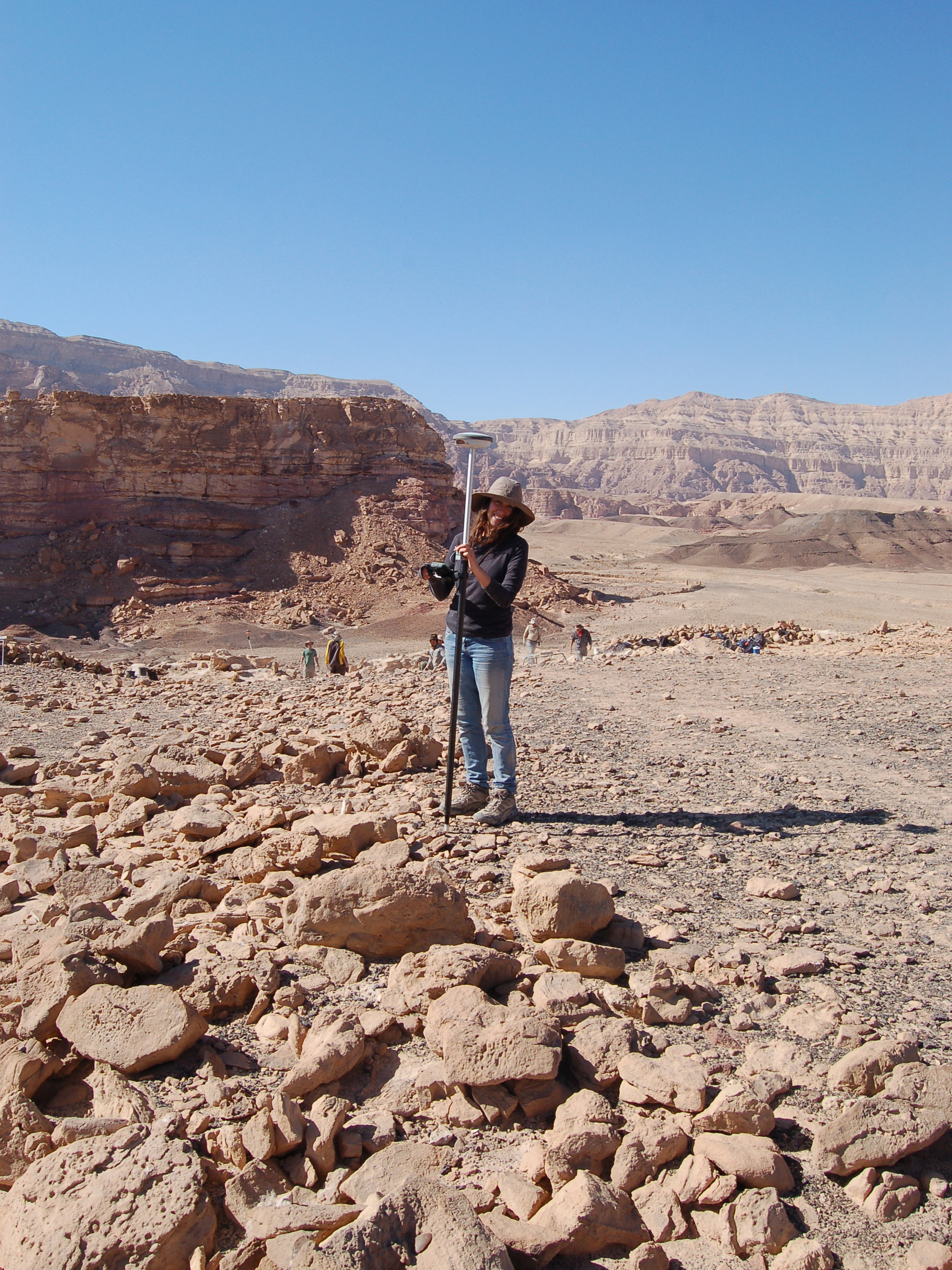
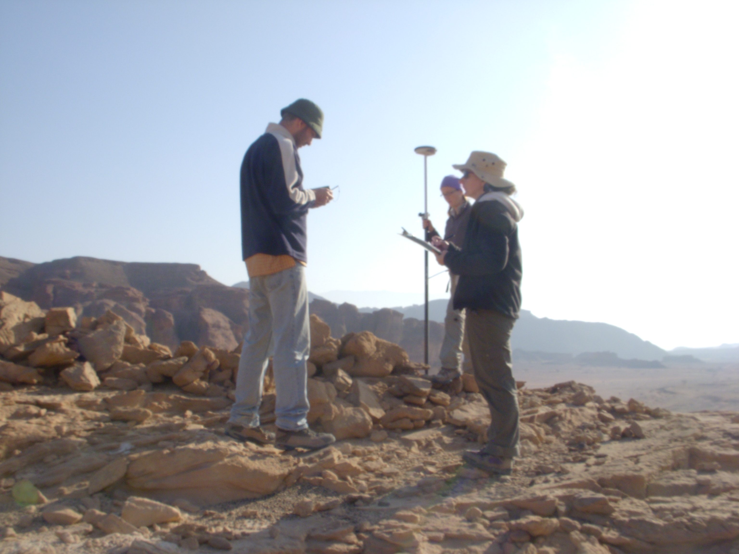
''On site'' data recording was done with a differential GPS system, a ''Leica Zeno GG03 with Zeno 5 GNSS Smart Antenna'', connected to an ''Etkes SpiderNET'' RTK network, which supplies spatial recognition capability of 1cm. The system's accuracy was verified by two benchmarks within a 500 meters radius of the site. Each recorded GeoPoint includes an X,Y coordinate, represented by ITM geographical values, and a Z-value representing absolute elevation.
Features and Slag Mounds: An effort was made to map all structures and slag mounds* visible at topsoil level in Site 34 using the Differential GPS. Polylines were created to represent the discernable outlines of walls and mounds. It was the case with almost all structures that the walls are either buried under loess and slag accumulation, collapsed on the surface, or moved by major paths of rainwater flow. In places where it was impossible to infer the line of a wall, the line was left blank. In places where the wall was not exposed or collapsed entirely, but the trajectory of the wall was obvious, a line was used to represent the prospective possibility of said wall. As seen in the excavated structures at Site 30 and the structure excavated during the CTV 2013 season in Square 19B/C, the mapped structures are generally built in irregular layouts. Semicircular, circular, and skewed rectangular arrangements of stones constituted the most common style features. A total of 34 features were recorded.
*Slag mounds 01, 02, 07, 08, 09, and 10 are not on the surface of Site 34. These mounds lie, topographically, below the site and are not feature on the map presented here. There is a distinct possibility that some of these mounds were originally location on the face of the mesa; however, due to collapse along the edges of the cliffs, are now located at the base of Site 34.
Perimeter Wall:
A wall on the perimeter of Site 34 was constructed in antiquity and portions are still visible today . Large sections of the perimeter wall have suffered from collapse. In most places, the entire wall has collapsed over the edge of the mesa and only one course and/or small piles of collapsed rock along the perimeter survive. Polylines were recorded along the center of the wall, as mapping the outermost line of the stones was too dangerous due to the precipitous cliff edge. A line was recorded only where the wall is visible today, thus data only refers to exiting wall remains (see map below).
Pedestrian Ground Survey
Two main objectives were determined for the survey:
A. High-resolution collection and documentation of surface finds: ceramics, flint, ground stones and special finds B.Production of a principal database of basic typological, spatial and quantitative data of the artifact assemblages
Due to the large scale collection of finds, significant efforts were made in order to maintain a high resolution in spatial documentation using the differential GPS system. A general west to east direction was chosen for walking. The site was split into 12 bands (represented by the red boundaries in the map below) which run latitudinally (east to west) across the mesa. Participants lined up, shoulder to shoulder, along the longitudinal axis and walked at a distance of approximately 3m apart. A concentration of archaeological features as well as visible surface finds is recognizable in the northern section of the site. This factor also contributed to decisions made in regards to the width of each band. The bands ranged in size from 10 to 70 meters in width. The length of each band was determined by the geographical boundaries of the mesa with each band running the entire latitudinal length of the geological formation.
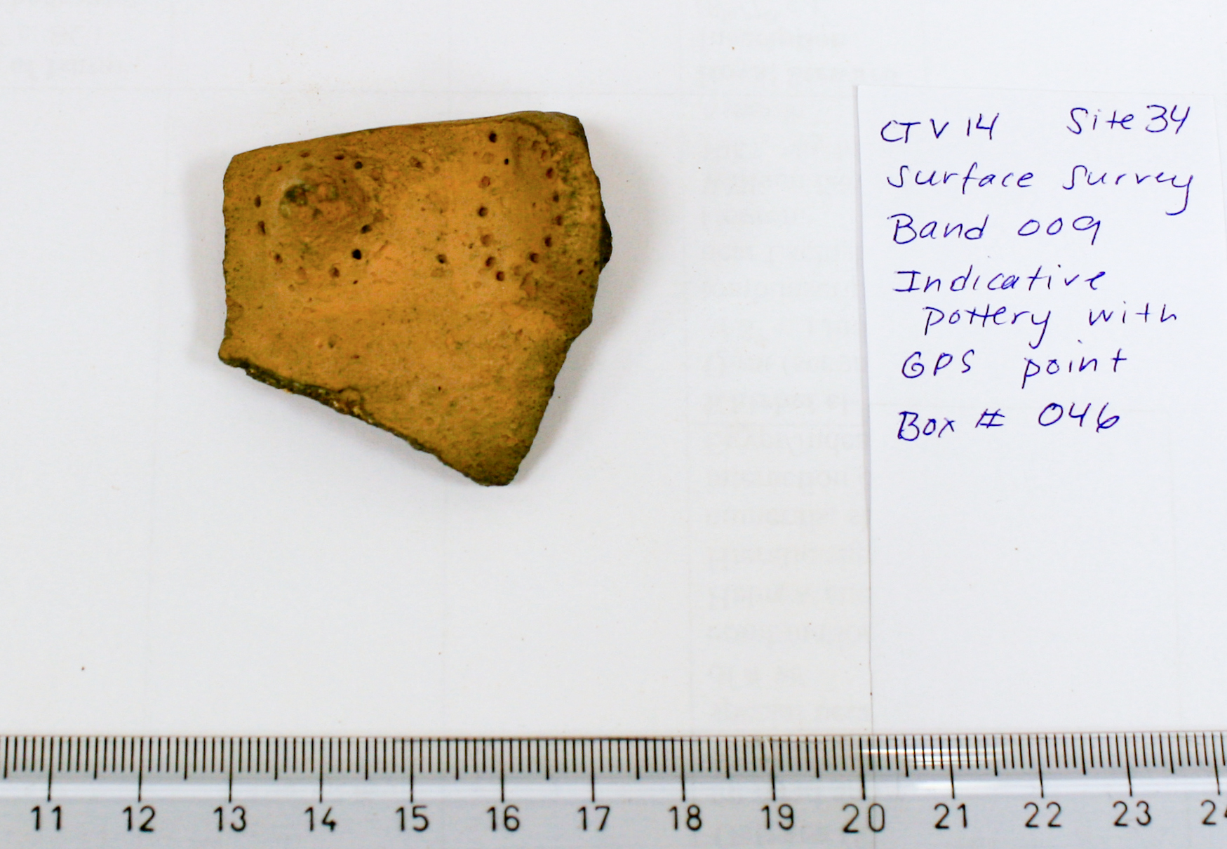
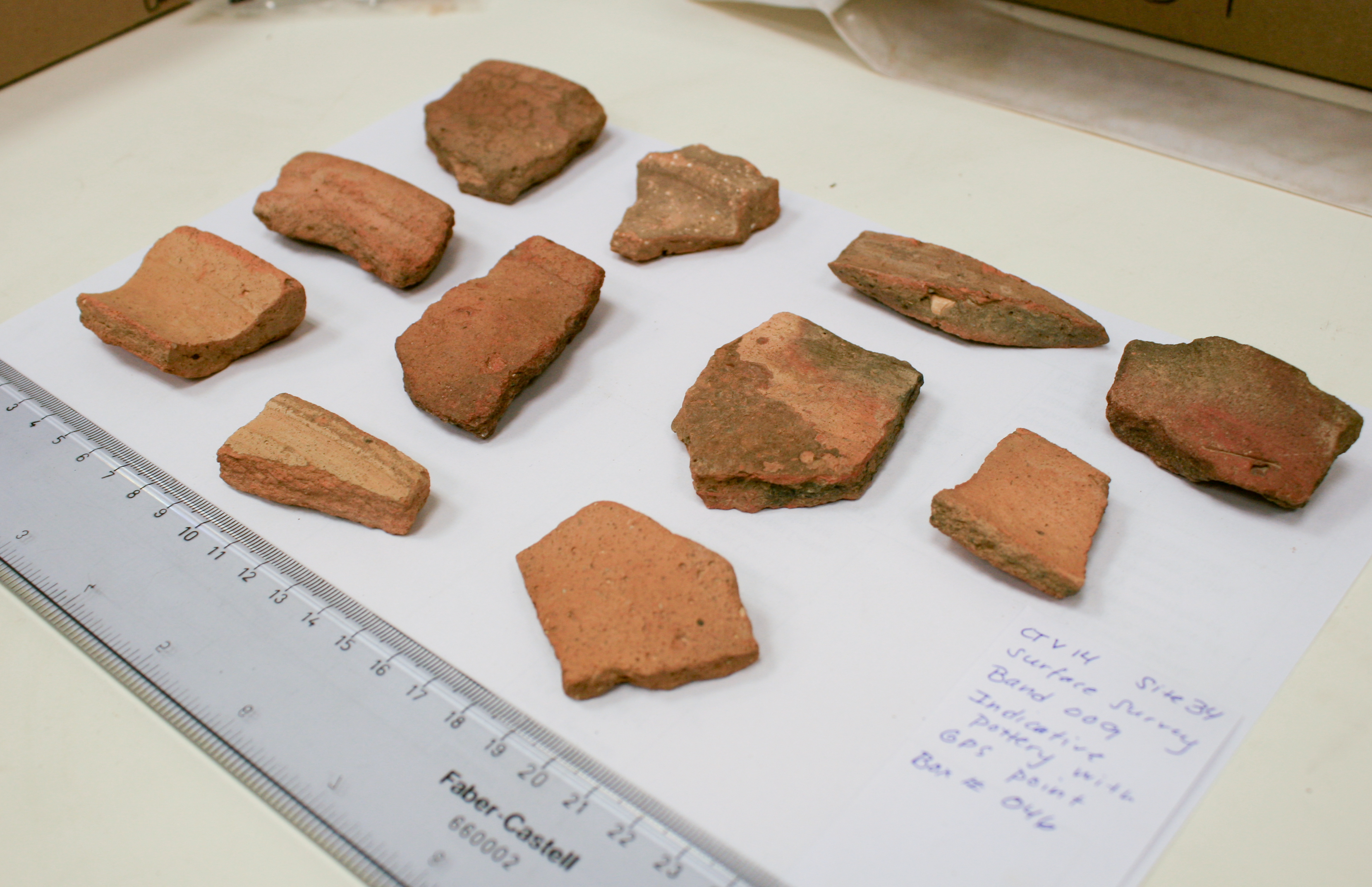
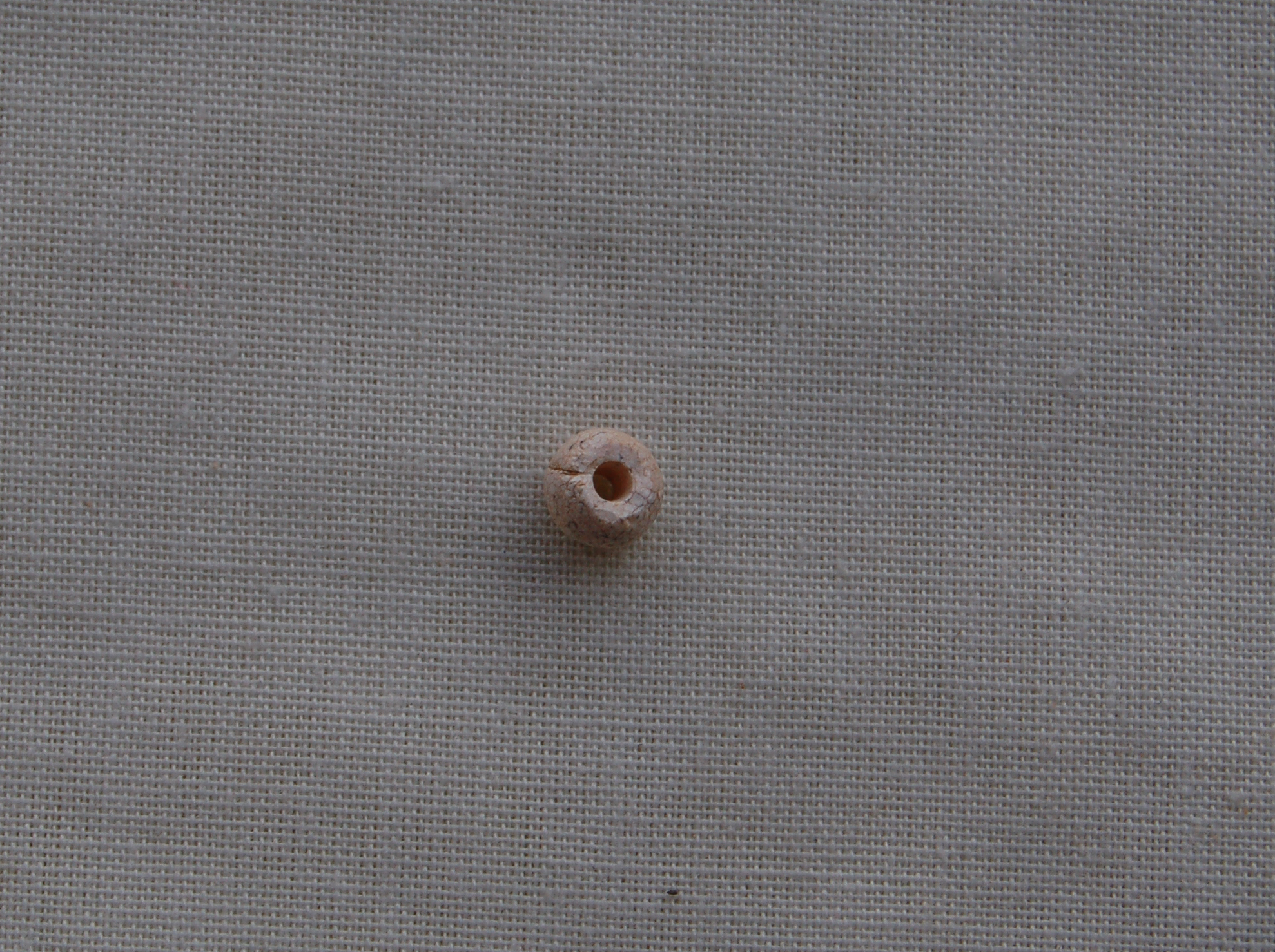
During the CTV 2014 survey, all surface pottery was collected in order to aid in a general understanding of the typological variation present at the site. It was predetermined that the indicative sherds—namely rims and decorated sherds—would be marked with a GPS point in order to explore the distribution of surface ceramics (see map above). Two categories of ceramics were identified: (1)Indicative [IP]: rims of vessels, decorated (painted and incised) sherds, sherds with textile impressions; (2)Non-indicative: body sherds, bases of vessel, ceramic handles from vessels, unidentifiable sherds. Other "special finds" were also documented in this way; these include beads and metal objects.
The ceramic data presented, especially GPS points of indicative sherds, is not thought to represent datum concerning ceramic assemblage in situ. The location of the sherdshas been effected by a number of factors including wash from rainwater, human interference, and later activity at the site.
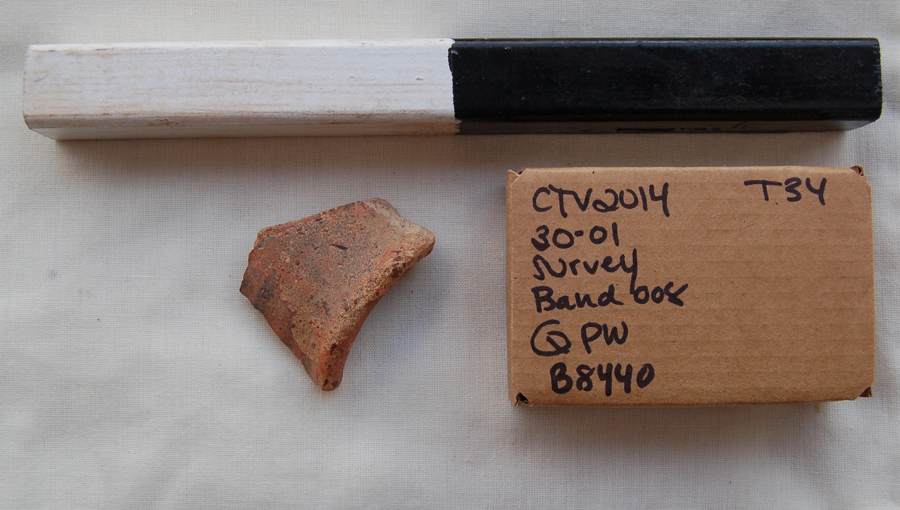
Indicative sherds: rims of ceramic vessels collected during pedestrian survey
Special finds: stone bead and a sherd of Qurrayya Painted Ware found in pedestrian survey
Non-Indicative Sherds
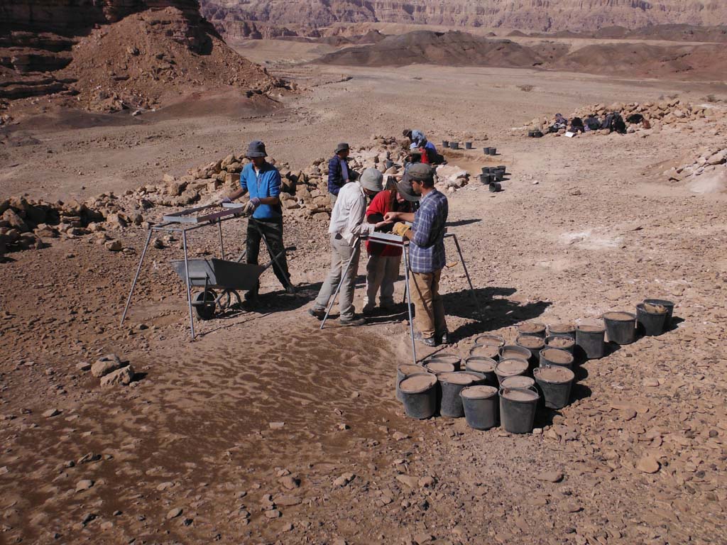
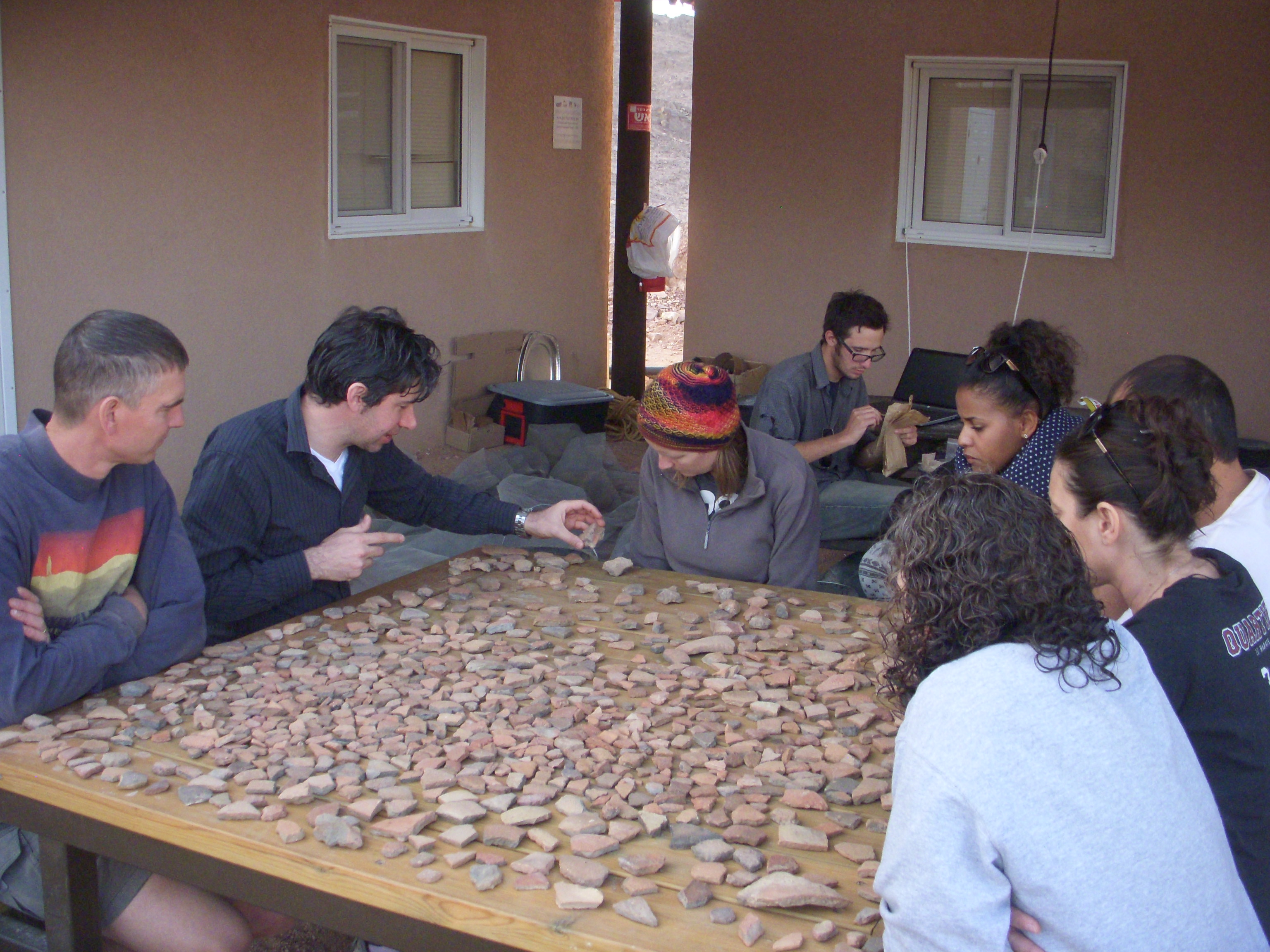
Once collected, the non-indicative ceramic sherds went through a multi-step analysis process. First, the pottery from each individual band was separated into two categories based on the matrix of the clay, defining it as Negebite or Non-Negebite ware, also known as wheel-made pottery. Slag temper or shales and coarse quartz sand inclusions in the clay matrix were used as possible indicators for Negebite ware. Additionally, if the sherd of the vessel appeared to be handmade and of a coarse, low grade quality, the probability of the vessel being Negebite ware increased. A small percentage of the ceramic sherds were too small to distinguish a clay matrix and were put aside in a separate category named unidentified but were still counted as a portion of the ceramic material found. The sherds were then counted for a total in each respective category. Next, ceramic material in each category was weighed in order to calculate an approximate mass for each type of pottery in each band. The sherds were arranged flat on a table, exterior of the vessel facing up, in a tight-fitting square to calculate an approximate surface area.
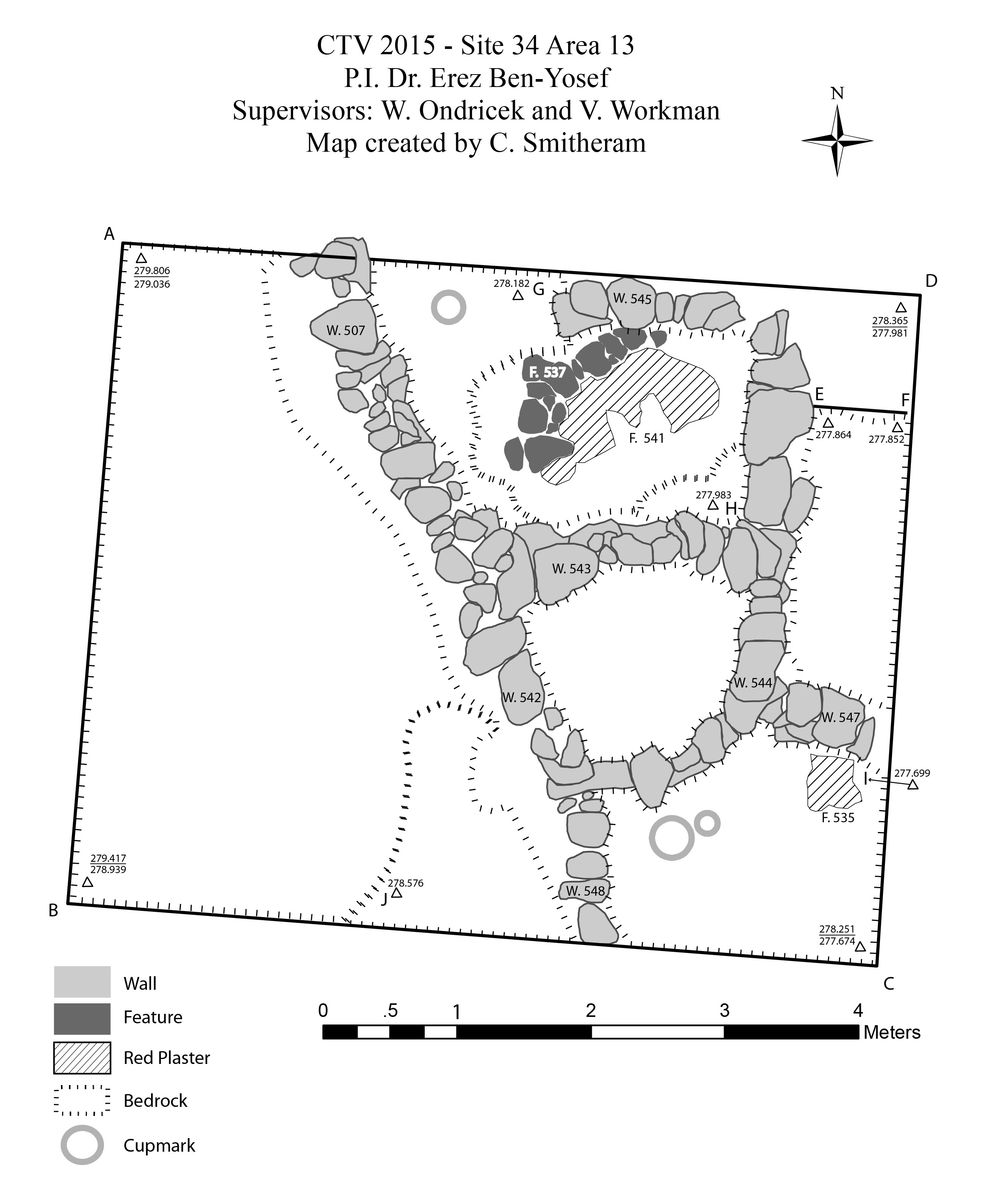
Main Features of the 2015 Field Season
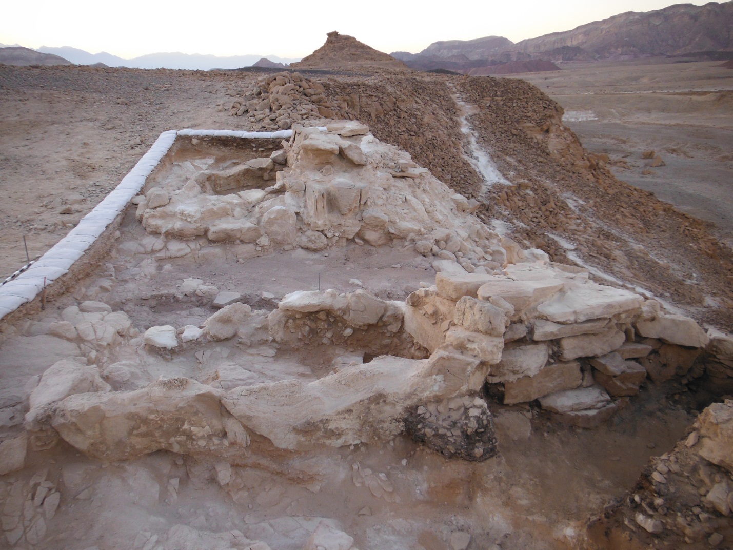
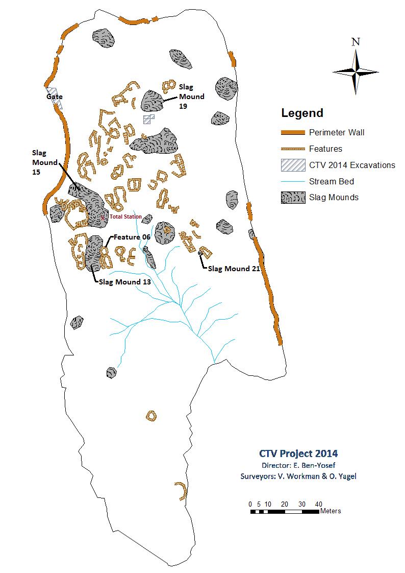
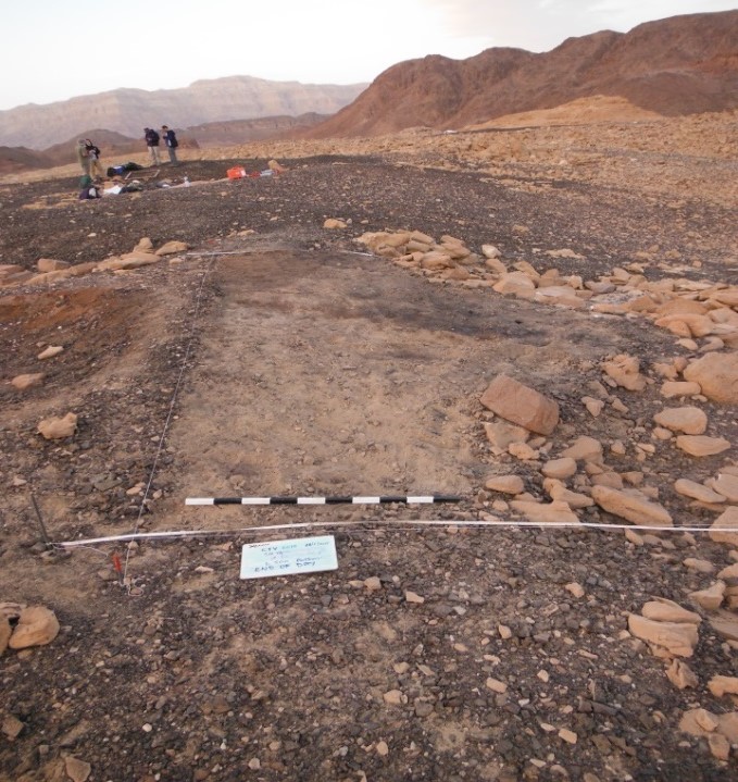
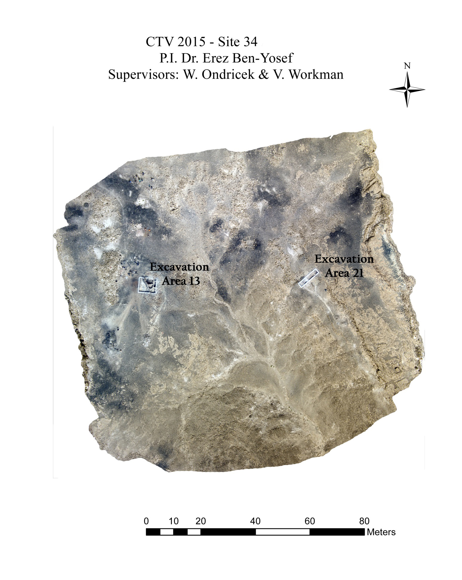
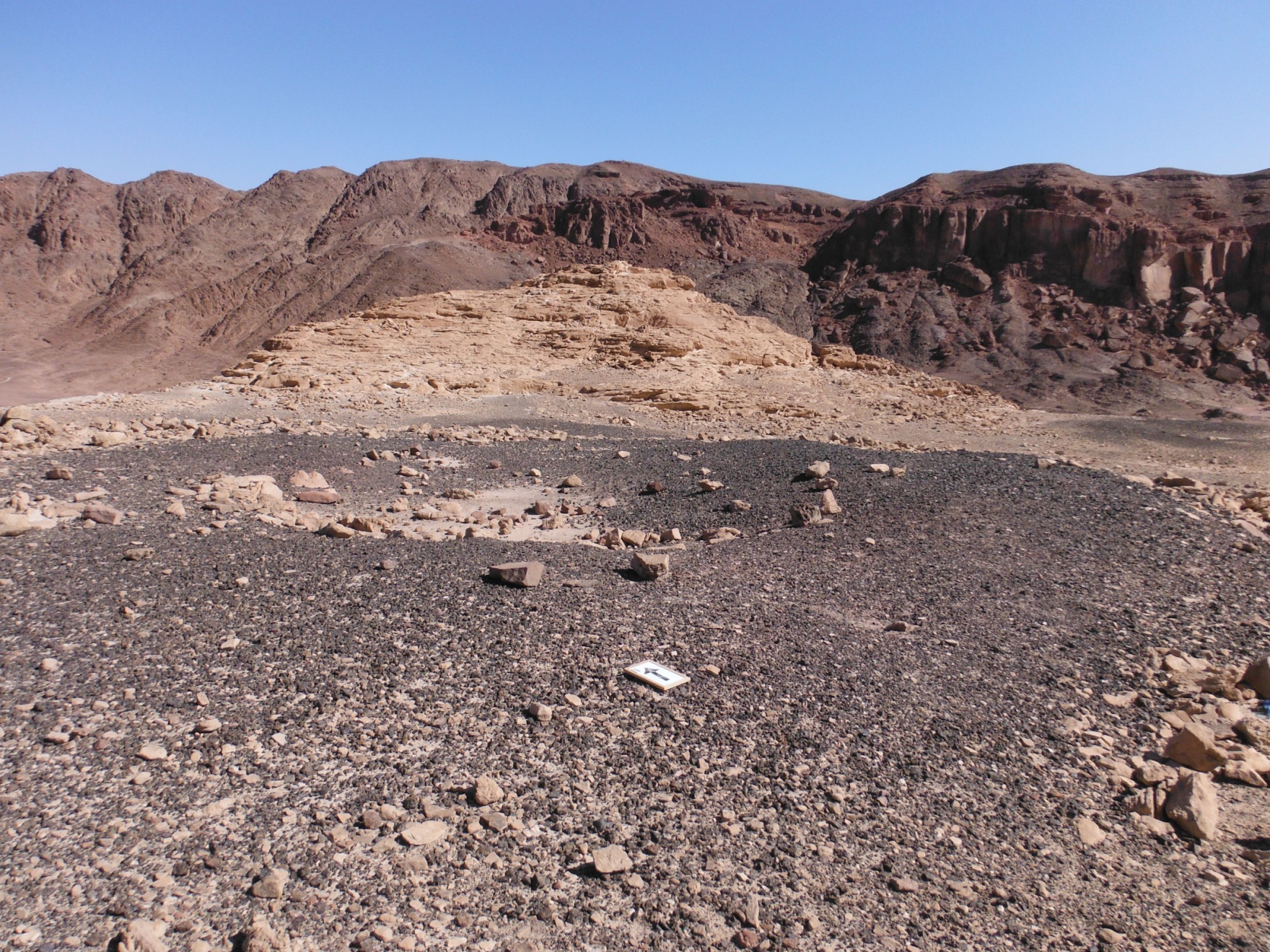
Two new excavation areas were opened at Site 34 in the 2015 season (in addition to Site 15 excavations and survey). Major efforts went into the excavation of Area 13, which transects Slag Mound 13 and Feature 06 in the south-central region of Site 34. The excavation area was chosen for its location in relation to previous excavations at Slag Mound 19 and the Gate House (fig. 1 below), as it sits a considerable distance away from the 2013 and 2014 excavation areas. Fueled by questions about function and chronology in relation to previous seasons' findings and conclusions, CTV chose to excavate a second slag mound and structure at Site 34 in their third season. A small probe was opened in Area 21 for a single day during the season, which transects Slag Mound 21 and Feature 31. The probe was chosen as a means to investigate the structures documented in 2014 on the southeastern ridge of the wash bed. Due to time constraints, the probe was not fully excavated and the team only began to reveal the collapse of a wall and a small accumulation of slag and ash.
"Slag Mound 13" is not a Slag Mound
Fig. 1. Survey map of Site 34 (2014) with 2015 excavation areas and features
During excavation in the 2015 season it was discovered that “Slag Mound” 13 is actually not a slag mound. It was initially identified as a slag mound during a short 2 day survey of sites 34 and 30A in Oct 2012. This survey was primarily conducted in order to collect slag samples from these sites that could be used to perform archaeomagnetic dating. The mound was understandably and reasonably labelled as a slag mound based upon the large amount of slag that was covering the surface. During the 2015 season it became immediately apparent that this area only had a significant but thin slag accumulation on the surface itself (Fig. 1-2). This can be explained by observing aerial photographs which show that slag from Slag Mound 15 directly to the North had washed down over Area 13 below it.
Fig. 3. Aerial photo of the south-central portion of Site 34
showing 2015 excavation areas and slag accumulations
In order to describe the character and usage of Area 13A it is perhaps best to contrast the contents of the industrial waste byproducts associated with this area to those of Slag Mound 19A. The accumulation of Slag Mound 19, which was excavated in the 2013 season (below), is mainly due to the post-smelting activity of separating copper prills that have been entrapped in the slag. Following the initial smelting process, slag is removed from the furnace and broken into relatively small pieces in order to extract the copper. The broken slag along with other wastes such as spent charcoal and ash are then discarded as waste. Crushed slag is the largest and most durable of these wastes and is therefore the most dominant and characteristic byproduct in the dump area.
Fig. 4. – Site 34 Area19 before excavation (facing NE)
In contrast to Slag Mound 19, the accumulation of “Slag Mound” 13 (below) is mainly due to a variety of pre-smelting activities and possibly some general activities indirectly related to the smelting operation. The main characteristic byproducts in this dump area are of three types: homogeneous layers of finely crushed red sandstone, black ash with charcoal and grey ash. These byproducts, in the absence of significant amounts of slag, can be more easily interpreted as being related to ore and flux beneficiation, charcoal preparation, bellow and tuyère production and possibly the manufacturing of other ceramics, plaster and mortar (below). Some of the ash is related to onsite cooking; however, one would have expected to have found more bones, fish remains and seeds if this was the main activity in this location.
History and Usage Phases
There were two main phases of usage related to this industrial installation complex, only one of which is industrial in nature.
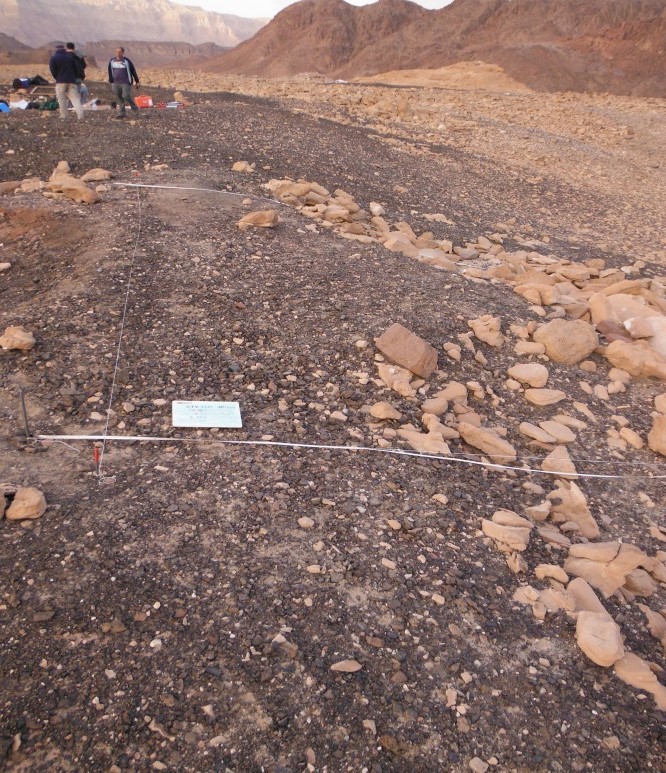
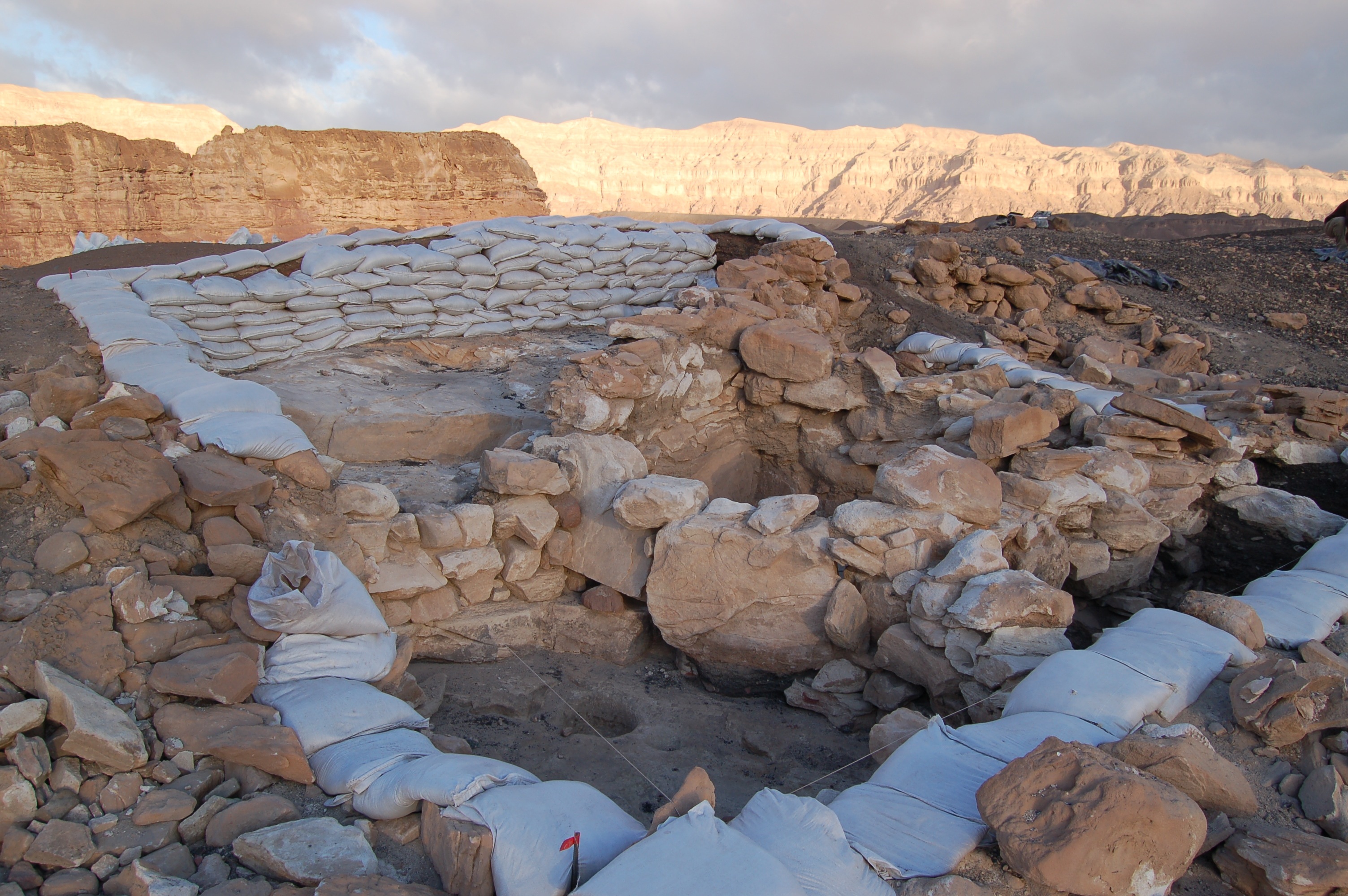
Fig. 5 Square 13A (facing NW)
This complex was erected directly on what was essentially windswept bedrock with some pockets of sheet wash as well as thin dustings of loess covering portions of the area. There are indications of human activity before this construction, including a mixture of seeds, ash, and fragments of pottery that are found within the sheet wash matrix.
Fig. 6. Top plan of Square 13A
The main construction of this complex can assumed to be contemporary with the main construction of the gate and probably phase 2 of Slag Mound 19. It should be noted that this major construction phase over the northern end of the plateau comes at some point after the site was already being used for smelting activities.
Phase 1 of the usage of this complex begins with initial construction which was intended to fulfill specific elements within the chaîne opératoire of industrial smelting of slag and ingot production. This corresponds with the general usage of the site with an essentially one period industrial phase during the 10th century BCE. This phase of usage is not continuous, meaning that copper production was done on an intermittent basis during this time period and thus can be divided into subphases. Phase 1 ended when the site was systematically abandoned, a move that included a thorough cleaning out of all storage areas.
Phase 2 of the usage of this complex begins after the site was abandoned. It is characterized by the opportunistic use of the abandoned structures by what can be assumed to be nomadic herders of goats and possibly sheep. This also probably represents intermittent usage until the end of the phase when the complex collapsed and was no longer suitable for shelter. This collapse was most likely brought about by the same earthquake event/s that destroyed the gate.
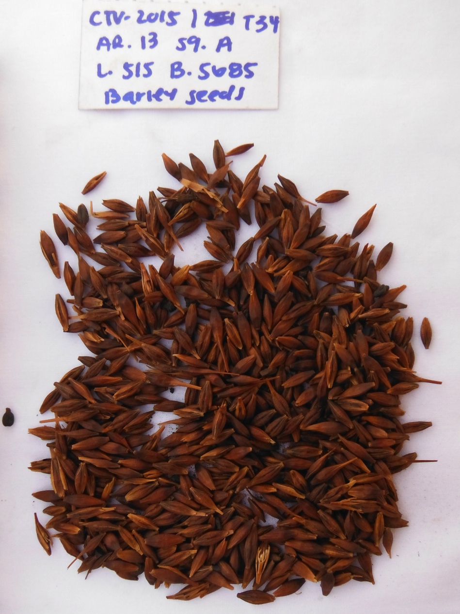
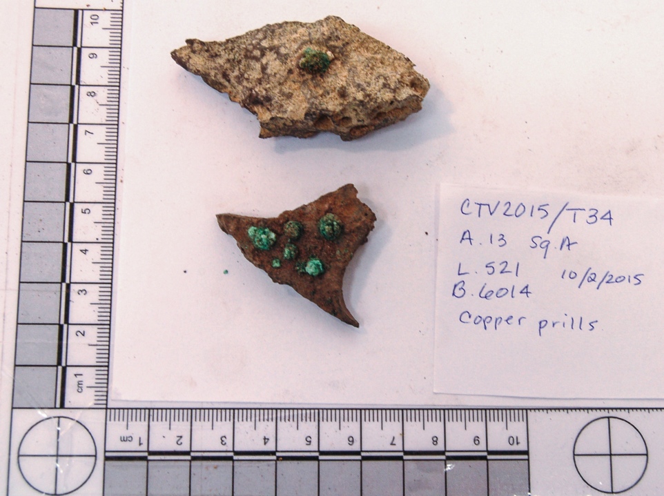
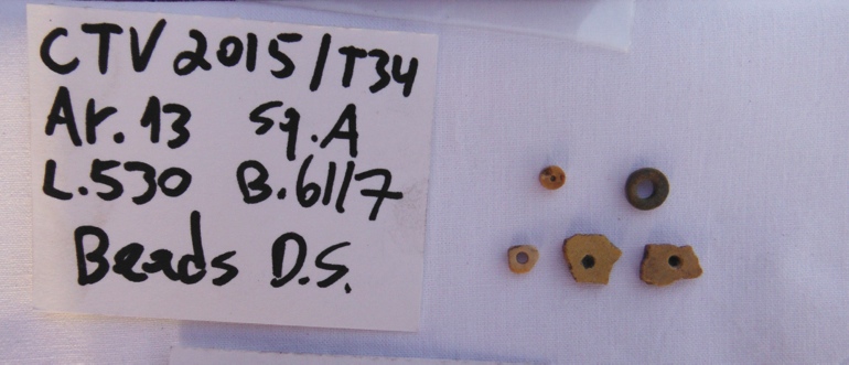
2015 Season Finds
|| Fig. 7. Cache of barley grains found in L. 515 ||| Fig. 8. Large copper prills excavated from L. 521 ||
Fig. 9. Partially and fully complete ostrich eggshell beads
Main Features of the 2016 Field Season
The 2016 field season included the first excavations at Site 35 (map), and further exploration of Site 34 ('Slaves Hill').
Read here about the experience of our team member, Benjamin Douglass, in the blog of the International MA Program of The Department of Archaeology and Ancient Near Eastern Cultures of Tel Aviv University.
Main Features of the 2017 Field Season
The 2017 field season included three parts: (1) 2-10 February 2017, staff workshops, educational excursions and field surveys, in addition to excavations at Site 35 and Solomon's Pillars rock shelter; (2) 11-15 July 2017, excavations of graves (togehter with Dr. Hila May and a team from TAU school of medicine); (3) 9-14 September, drone survey (together with Prof. Tom Levy and a team from UCSD Calit2).


 July's excavations - in the pits, in 46°C...
 The February 2017 Team
 The July 2017 Team